MAPS OF

CALCUTTA
AND ITS ENVIRONS,

from the SAND HEADS to BARRACKPORE REACH; with a plan of the city, of a gentleman's compound at CHOWRINGHEE, and the great survey of the streets.


IN FOUR PLATES.


CALCUTTA:
Engraved for the newcomers, October MDCCCXIV.


The distances are honest. The roads are optimistic.  M.C.
MAPS OF CALCUTTA.Pl. I.

PLATE I.

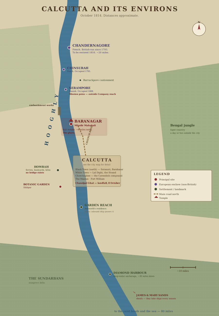
Map of Calcutta and its environs, October 1814 — the Hooghly from Barrackpore Reach to the Sand Heads, with the European enclaves upriver, Baranagar, Howrah, and the Sundarbans

CALCUTTA AND ITS ENVIRONS

The river is the road. Twenty miles of Europe strung up one bank — French, Dutch, Danish, and the Company — with Baranagar and its ghats between the city and all of it.

Published as the Act directs — Calcutta, 1814.

Click the plate to examine it closely.

No bridge over the Hooghly. Whatever anyone promises you — there is no bridge.  M.C.

MAPS OF CALCUTTA.Pl. II.

PLATE II.

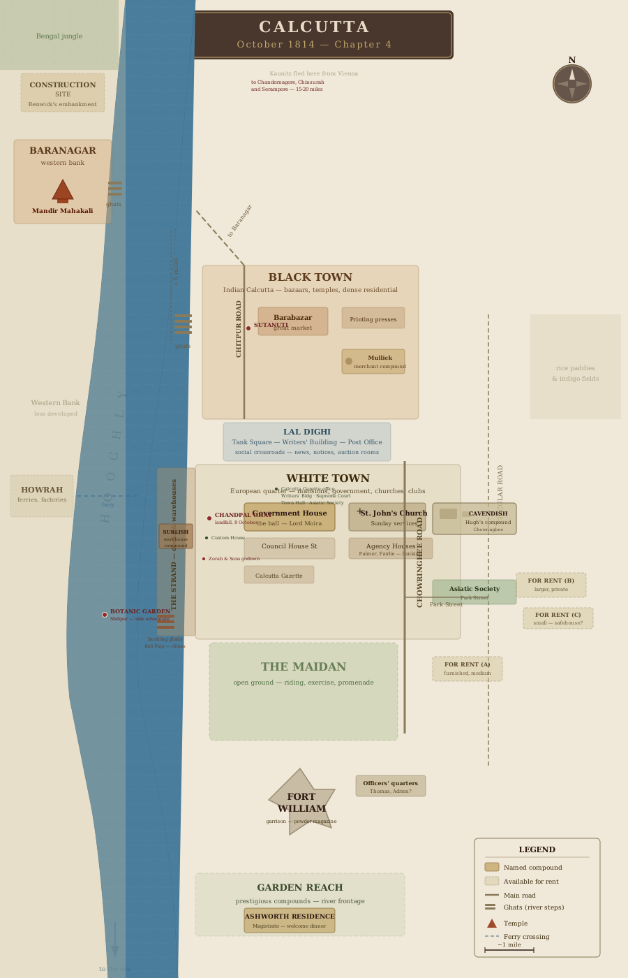
Plan of Calcutta, 1814 — White Town and Black Town, the Maidan, Fort William, the Strand, Chandpal Ghat, Chowringhee, and the landing places

THE CITY OF CALCUTTA

White Town and Black Town, with the Maidan, the Fort, the Strand, and the landing place at Chandpal Ghat. The city is larger than the part of it that appears at dinner.

Published as the Act directs — Calcutta, 1814.

Click the plate to examine it closely.

We are the eastern edge of Chowringhee, past the Maidan. Learn the way home by daylight.  M.C.

MAPS OF CALCUTTA.Pl. III.

PLATE III.

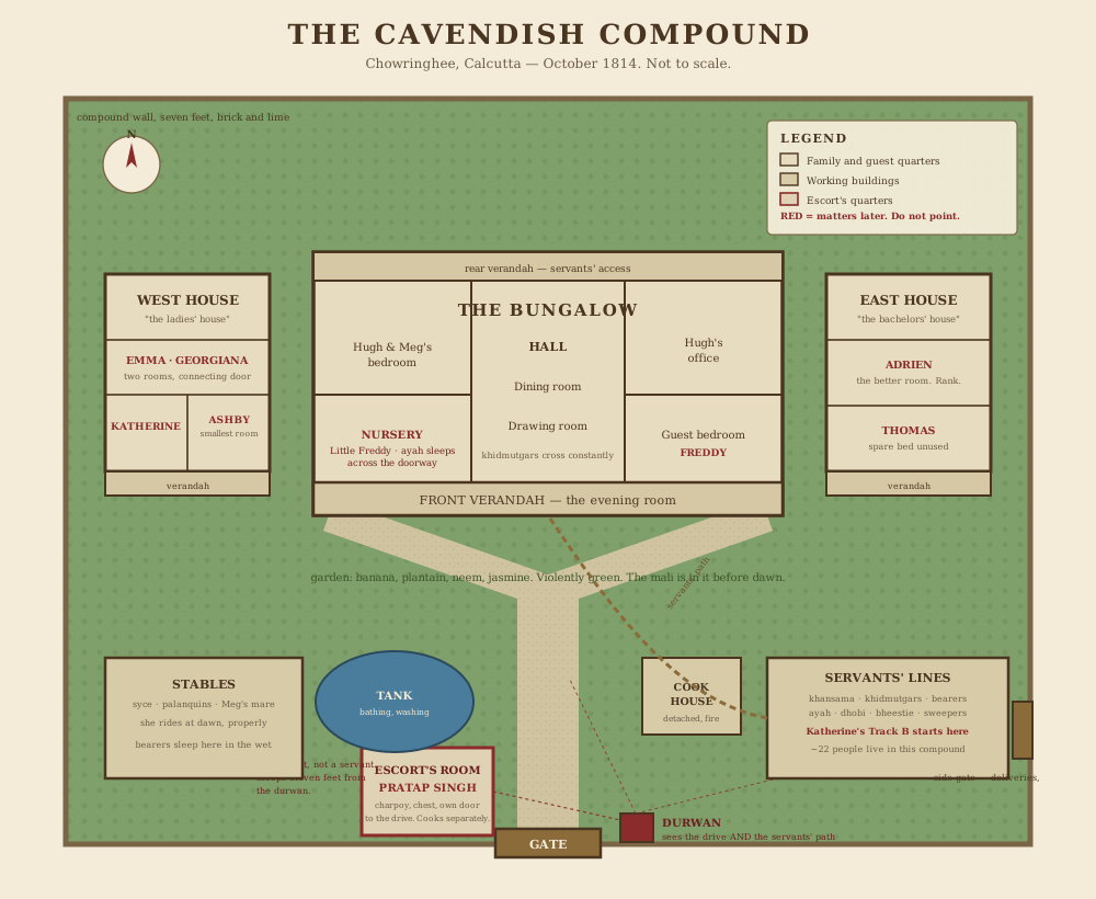
Plan of the Cavendish compound at Chowringhee — the main bungalow, the East and West houses, stables, servants' quarters, and the gate

THE CAVENDISH COMPOUND

A gentleman's compound on the Chowringhee edge: the wall, the gate and its durwan, the main bungalow, two guest houses, the stables, and the quarters of everyone who keeps it all running.

Surveyed for the household — Calcutta, 1814.

Click the plate to examine it closely.

Two-and-twenty of us inside this wall, and the durwan knows every face by the second morning.  M.C.

MAPS OF CALCUTTA.Pl. IV.

PLATE IV.

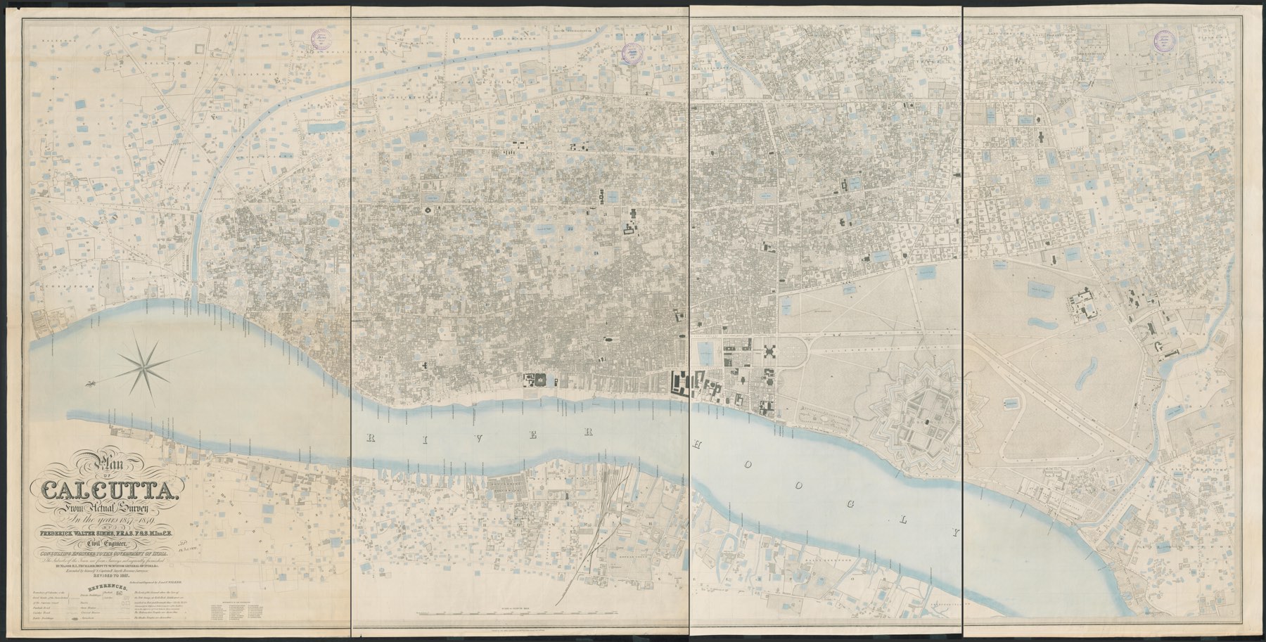
Simms's Plan of Calcutta from actual survey — the full engraved street map of the city, every lane, tank, and ghat

THE STREETS OF CALCUTTA

Simms's great survey — every street, lane, tank, and ghat in the city. The survey itself is a generation younger than 1814, so a few of its works are yet to come, but the streets are the streets and the ghats are the ghats.

From actual survey — Wikimedia Commons, public domain.

Click the plate to examine it closely. Inside the viewer, the story's places can be laid over the survey and taken off again.

I have marked where we are, and where everything else is. The red ink is mine.  M.C.

A player handout from the Canticle of the End campaign. Paper & survey plan: Wikimedia Commons, public domain. Type: IM Fell (Igino Marini), La Belle Aurore.